Applications of GIS for Urban Development and Housing in Ulaanbaatar city, Mongolia
Amarsanaa Amarbayasgalan and Changping ZHANG
Abstract: Ulaanbaatar is the capital city of Mongolia in which over 1,000,000 residents and about 40 percent of total population are living. Because of the centralizing of population, industries and economics, many difficulties of infrastructure, housing, health and public services of city, and negative influences of environment and residents health are caused here. In result of continouas migration to Ulaanbaatar city, rapid mechanical growth of population has occurred. Population density has been growing up intensively. Settle zone of ger area has tremendously increased. At present, redevelopment of ger area and housing is one of the important issues which are facing in the Ulaanbaatar city. For urban planning propose, the urban development database are created and managed by Construction, Urban Development and Planning Department (CUDPD) of Ulaanbaatar city. Though some government agencies are using GIS for their operations, still it has facing problems such as lack of cooperated effort, poor ability of data sharing. Therefore this paper attempts to discuss GIS applications which are using for current urban development and future trend of development of GIS. Moreover the paper also discusses how to implement the sharing and interoperability of spatial data efficiently and make it accessible to the different agencies.
Keywords: ger area, urban development, housing, GIS, data sharing, Ulaanbaatar
1. Introduction
Due to the transfiguration of the area of communism to democracy in 1990, there have been so many extreme changes in both political and social life.
About 40 percent total population has been moving into the capital city of Ulaanbaatar in last years. In result of current continouas regional migration to Ulaanbaatar city, rapid growth of population has occurred. The population density has been growing up intensively. Settle zones of ger area have tremendously increased without any planning (Fig. 1).
But these problems have not received adequate attention in the urban development plan as an integral
part of matter Ulaanbaatar city. Today, the situation has not changed and ger areas are still expanding rapidly. They have become a source of air, soil and water pollution of Ulaanbaatar city leading to poor quality of life for residents in ger areas as well as those living in the city’s built-up core area. Obviously
Source: CUDPD Figure 1. Spatial growth of ger areas 2000(blue) and 2008(red) G.S. of Graduate School of Regional Development Studies,
Toyo university
Hakusan Campus 2, 2-36-5 Hakusan, Bunkyo -ku, Tokyo, Japan 112-0001
Phone: 080-4072-1431, Email: [email protected]
the urban planning system has played an important role in managing and controlling the development trends. In Ulaanbaatar city, Construction Urban Development and Planning Department (CUDPD) has a duty to provide city development plan and redevelopment plans for ger area.
2. Construction Urban Development and Planning Department (CUDPD)
As an implementing agency under Ulaanbaatar city mayor, CUDPD manages to make rational policy on city development, land administration and infrastructure, to prepare master and detailed development plans for Ulaanbaatar city, to develop urban development database, to monitor newly constructed buildings in the city. As one of the divisions of the department, the information technology division manages with urban development database of Ulaanbaatar city. They gather, process, and renovate required data and information as well as share the neccessary database with related organizations, corporates and civilians.
For development of the above mentioned database, the division has established Ulaanbaatar basic digital maps, thematic maps and data sources of underneath construction engineering line. A management
Source: CUDPD Figure 2. Management information system for building
registration
information system of building registry has also been established which include several location and registration information of state and private buildings and related attributes (Fig. 2).
3. GIS for urban planning
In the essence of GIS in the plan making process, Calkins (1972) suggested that better planning will be achieved through better information and better information will necessarily flow from an information system. GIS provides planners, surveyors, and engineers with the tools. They can use them to design and map their neighborhoods and cities. GIS enable data from wide variety of sources and data formats to be integrated together in a common scheme of geographical referencing, thus providing up-to-date information (Grimshaw, 1988; Coulson and Bromley, 1990).
CUDPD maintains urban planning and housing information either on paper map or spatial databases (Fig. 3). The department already established several
.
Source: CUDPD Figure 3. Urban planning database
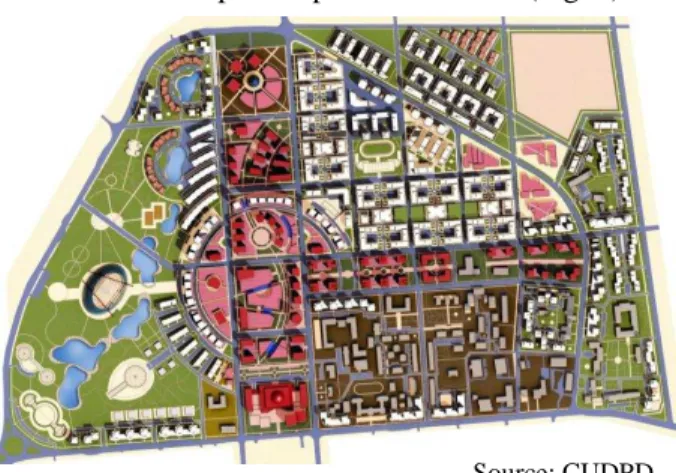
spatial databases such as urban planning, education, health and infrastructure as well as management information system for building registration and lighting facilities. Besides that, the department has introduced GIS to make redevelopment plans and
strategies for ger areas. They have planned into three categories to improve current ger district condition, to make adjustments, to have residents settle permanently, to transfer ger district into house district and further develop into apartment district (Fig. 4).
Source: CUDPD Figure 4. Redevelopment plan for ger area
4. The existing GIS users in Ulaanbaatar city At present, some of the government agencies such as Land Administration Office, Meteorology Agency and Department of Road are using GIS tools for their operations separately (Fig. 5). For example, The Land Administration Office is using land information system (LIS) to make digital cadastral map and some GIS tools for their daily activities. It is also noted that these GIS used in agencies are stand alone systems.
Figure 5. Existing GIS system in Ulaanbaatar city
CUDPD attempts to update the data and information with collaboration of the other relevant agencies
continuously. As using these independent GIS related tools for the urban development, many problems for the government agencies as well as public have been created. Furthermore this poor connectivity has severely affected to the integrated urban development process. Poor data sharing, absence of open data policy and lack of standard have deteriorated the existing GIS system.
Moreover due to the separated data archiving and disclosement of information between agencies, the coordination and cooperation of local government units (LGU’s) are disturbed, which leads to adminstration bureaucracy, unacceptable extra cost and time waste to the public customers. The government, public and private sectors have to invest huge amount of money to produce geospatial data.
Without a coordinated effort, duplicate data for the same locality or region could be collected by multiple organizations using various definitions of time, at different spatial scales, and with varying degrees of accuracy. For many of these data collection activities, there are redundant data which already exist but they are hard to find, frequently undocumented, and in incompatible formats. The Common spatial database is designed to be a collaborative effort. The framework data represent the best available data that are certified, standardized, and described according to a common standard.
5. Findings
Geographic Information System is a part of the Planning Support Systems (PSS), which can support decision-making and urban problem solving to a considerable extent. The ability of GIS to store, manage and manipulate large amounts of spatial data
provides urban planners with a powerful tool.
Therefore it is necessary to introduce the integrated GIS system to intensify the urban development process in Ulaanbaatar city (Fig. 6).
Figure 6. Purposed Integrated GIS system
This kind of system can be to reduce duplication of effort among agencies, improve quality and reduce costs related to geographic information, make geographic data more accessible to the public, increase the benefits of using available data and establish key partnerships with cities, make LGU’s and the private sector to increase data availability.
This kind of system can also improve data sharing between the agencies which is necessary to develop Web based GIS system and will be facilitated to solve the above mentioned issues at current sutiation with full accessibilty of the public using internet.
This kind of system will be also benefited to acceleartion of rapidly development of information and technology in the country. Also the web based system can be operated on internet which will be able to provide benefits for the users with easy access to the database. To enable data sharing among different data-producing units, some basic information about the data, such as the metadata must be provided.
Finally GIS provides urban planners with new tools to implement their work more efficiently, to
understand the dynamics of urban growth and to set forth better and practical urban development.
References
Amarsanaa, A. and Gantulga, B., 2008.
Redevelopment of Some Selected Ger Areas. Urban Land Administration-2007, in Ulaanbaatar.
Calkins, H.W., 1972. An information system and monitoring framework for plan implementation and the continuing planning process. Unpublished Ph.D. Thesis, University of Washington, Seattle, USA.
Construction, Urban Development and Planning Department of Ulaanbaatar city, 2007. Prospective of urban development in Ulaanbaatar City.
www.cud.ub.gov.mn, 2007.
Coulson, M. and Bromley, R., 1990. The assessment of the users needs for corporate GIS: The example of swansea council. Proceedings of the European Conference on Geographic Information Systems, in Amsterdam, EGIS Foundation, Utrecht, 209-217.
Grimshaw, D.J., 1988. The use of land and property.
Information System, 2, 57-68.
Municipality of Ulaanbaatar, 2007. Ger-Area Upgrading Strategy and Investment Plan (GUSIP) for Ulaanbaatar (UN-Habitat).
National Academy of Sciences, 2003. GIS for Housing and Urban Development. National Academies press.
Yaakup, A., Nazri, A. and Ludin, M., 2005. GIS in Urban Planning and Management: Malaysian Experience. International Symposium & Exhibition on Geoinformation, in Pulau Pinang.