Multi-Agent Systems for Modeling Urban Dynamics:
A Case Study of the Tokyo Metropolitan Area
Yumin ZHANG, Yuji MURAYAMA
Abstract: This paper describes an urban model combing multi-Agent Systems (MAS) with Cellular Automata (CA). The model consists of a series of environmental layers and multi-agents, which can interact with each other. It attempts to explore the interactions between different agents, such as land holds and governments, and between these agents and the environment. These interactions can give rise to urban macro-spatial patterns. Multinomial Logit Model was approached to calibration on Urban Agent behavior with environment. This model is used to simulate the urban dynamics of the Tokyo Metropolis Area in 1984―1994. The study indicates that MAS has better performance for simulating complex cities.
Keywords: Multi-Agent Systems, Spatial Model, Urban Dynamics, Multinomial Logit Model, Geosimulation
1. Introduction
1Urban dynamics appear much more complex due to the impact of recent developments in information and communication technology which leads to changes in life style, demographic composition, landscape and environment.
Understanding urban dynamics using spatial analysis and modeling has been challenging on the ground of GeoComputation and Geographical Information Science and enrich theory and practices in the field of urban modeling(Batty 2005).
The current generation of urban modeling (cellular automata modeling and Age-based modeling) has improved weaknesses, such as their centralized approach, poor treatment of dynamics, weak attention to detail, shortcoming in usability, reduced flexibility, and lack of realism(Torrens 2001). However, there still have such-and-such problem to apply it into practical and operational uses.
CA model are constrained by their simplicity, and their ability to represent real-world phenomena(Parker et al. 2003, Torrens et al. 2007).
MAS allow us to simulate the individual actions of diverse agent, flexible behavior mechanism, but it has some drawbacks in real-world phenomena too,
張 育民:〒305-8572茨城県つくば市天王台1-1-1 筑波大学大学院生命環境科学研究科空間情報分野 Tel: 090-4168-5856
Email: [email protected]
as it is so complex with too many parameters for representing agents and behaviors(XUE et al. 2003, Semboloni et al. 2004, XUE et al. 2004).
This study focuses the issue of Multi-Agent System Model, integrated with CA, and improves it to simulate urban dynamics in reality.
2. Methods
Firstly, we bring forth the model of integrating MAS and CA, and define the Agents, their behaviors, and their interactive with urban environment.
Secondly, we use exploratory data analysis, spatial logistic regression, and variables and GIS data analysis method to calibrate the parameter of model.
Thirdly, we employ the model to simulate the land use change and evaluate the result with reality using structural measurement, fractal analysis method.
3. MAS-Based urban dynamics model 3.1 Agents
(1) Urban Agents
Relative to active urban land-use categories, Urban Agents include residential agents, commercial agents, industrial agent and transitional land agents.
Each kind of Agent is a delegate who is going to
hold the kind of land.
(2)Governmental Agent
As a special agent, the governmental agent is not with complex properties, but it can take complex behaviors to react to urban agents and environment, which have the decisive effects on urban dynamics.
3.2 Landscape Environment
The Landscape Environment is expressed by cellular automata model.
3.3 Behaviors of Urban Agents
(1) Location choice -Individual agent decision making
According to the principle of utility maximization, they choice locating or moving by their preference with their properties. The behavior explained by taking discrete choice.
( )
ik ik
U = U Z (1) Where U
ikis the utility of a decision maker(urban agent) i making choice location k K ∈ (all the unoccupied urban land use units make up the choice set);, Z
ikis a vector of the attribute value for alternative k as viewed by decision maker i , such as transport time, cost etc. In this study, we choose the least distances to CBD, Sub city centers, rail stations, rail lines, highways, national roads, main local roads.
max(
jk)
AG jk
jk k K
P U
U
∈
= ∑ ( j = 1, 2,..., J ) (2)
Where P
jkAGis The probability of accepted a decision maker i , i.e. the probability that land unite in the location k convert into the land use j of a decision maker i ; J is the Number of active urban land use.
The most widely used manifestation of the discrete choice model in urban simulation is the random utility model and its most common derivate is multinomial logit model (Cheng et al.
2003, Fang et al. 2005). The equation (2) can be described as follows:
1
ln
AG m
jk AG AG
j ji ik
AG Jk i
P Z
P α β
=
⎛ ⎞
= + ⋅
⎜ ⎟
⎜ ⎟
⎝ ⎠ ∑
( j = 1, 2,3,..., J − 1) (3)
1
ln 1 1
AG m AG
J Ji ik
AG i
Jk
P α β Z
=
⎛ ⎞
= + ⋅
⎜ − ⎟
⎝ ⎠ ∑ (4)
We can calibrate parameters α
AGjand β
jiAG( j = 1, 2,..., J ) using multinomial logistic regression and binary logistic regression by SPSS.
(2) Communicate with the Environment – through neighborhood and land use suitability
1
1 1 exp
CA
jk n jk
CA CA
j ji ik
i
P S
α β N
=
= ⋅
⎡ ⎛ ⎞ ⎤
+ ⎢ − ⎜ + ⋅ ⎟ ⎥
⎝ ⎠
⎣ ∑ ⎦ (5)
where N
ikis the Number of land use type i in the Neighborhood ( 7 7 × ) of location agent k ;
CA
P
jkis the probability that location k is accepted as land use j by urban environment;
S
jkis land use suitability.
3.4 Control and coordinate by Governmental agent
AG CA GOV
jk jk jk jk
P = P ⋅ P ⋅ P (6) where P
jkis the probability that location k is accepted as land use j at last;
GOV
P
jkis the probability that location k is accepted as land use j by Government agent;
Whether Location k is accepted as land use j
or not is decided by the Monto Carlo Method.
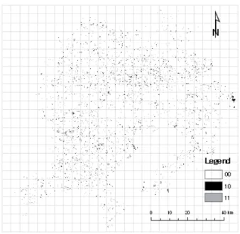
4. Study Area and Data
The Study Area (the Tokyo metropolitan Area) comprises most area of 5 prefectures, Tokyo, Saitama, Ibaraki, Chiba and Kanagawa, Total Area is 8264 km
2. From 1950s, with the rapid growth of population, urban land use changed greatly.
In this study, Detailed Digital Information (10m Grid Land Use) transportation (rail line, rail station, roads), land condition and land use zoning data sets were used.
5. Calibration , Results and Assessment
5.1 Calibration
Fig. 1 The process of urban agent location selection
Where
AG
P
jkis The probability of accepted a decision maker i ;
CA
P
jkis the probability that location k is accepted as land use j by urban environment;
GOV